Sant Esteve d'en Bas - Condreu - Roda de Ter - Rupit - Sant Esteve d'en Bas
Sant Esteve d'en Bas - Condreu - Roda de Ter - Rupit - Sant Esteve d'en Bas
Transfer needed 60'
 Distance:
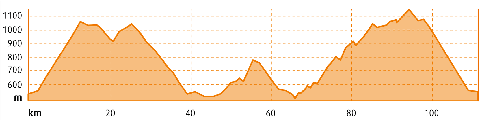
111,5 km
Distance:
111,5 km
 Elevation gain:
1.150 m
Elevation gain:
1.150 m
 Max. Elevation:
1.720 m
Max. Elevation:
1.720 m
Water points
- Sant Esteve d’en Bas
- Roda de Ter
- Folgueroles
- Vilanova de Sau
- Rupit
- El Far
|
MOUNTAIN PASSES |
CATEGORY |
DISTANCE |
ELEV. CHANGE |
AVERAGE % |
MAX. GRADE |
||
|
Condreu |
2 |
11 km |
2,48 mi |
615 m |
1.115 ft |
4% |
7,4% |
|
Rupit High Sanctuary of El Far |
1 |
24 km |
3,72 mi |
400 m |
1.342 ft |
2,4% |
12% |
|
El Bac |
3 |
6 km |
200 m |
4% |
6% |
||
|
SECTIONS WITH TRAFFIC DENSITY / ROAD SURFACE DEFECTS |
HIGH DENSITY |
MEDIUM DENSITY |
LOW DENSITY |
|
Sant Esteve d’en Bas - Santa Maria de Corcó |

Secondary road |
||
|
Santa Maria de Corcó - Roda de Ter |

Urban stretch |
||
|
Roda de Ter - Vilanova de Sau |
Secondary road |
||
|
Vilanova de Sau - Rupit |
Asphalted track |
||
|
Rupit - el Far - Sant Esteve d’en Bas |
Secondary road |
We depart from the car park of the municipal swimming pool of Sant Esteve d’en Bas, right by the Olot – Sant Feliu de Guíxols Greenway. There’s plenty of parking available here, along with a bar-restaurant and, of course, the municipal swimming pool if you fancy cooling off after the ride.
We take the C-153 road in the direction of Hostalets d’en Bas, which will lead us up to the Condreu Pass, after which we tackle the climb to the Bac Pass. We pass through the charming town of Cantonigròs, where a long, fast descent takes us to Roda de Ter.
Crossing over the Ter River, we take the BV-5213 road; a few metres further on we take the turn-off on the left in the direction of Tavèrnoles. Just before we reach Tavèrnoles, we come to a narrow road that takes us to Folgueroles. At Folgueroles we take the N-141 road that leads us to Vilanova de Sau and the Sau Reservoir.
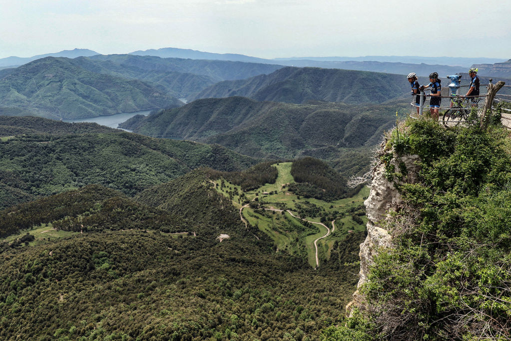
Once we reach this point, we’re surrounded by the magnificent landscape of the reservoir and the Tavertet Cliffs. Here we take a constantly undulating asphalted rural track all the way to Rupit above the impressive Sallent Waterfall. A must-see attraction!
Once again we take the C-153 road, this time in the direction of Susqueda. Once we reach the top of the Condreu Pass, we can visit the El Far Sanctuary. Highly recommended! This vantage point offers us extraordinary views of the entire county. There’s also a restaurant-cafeteria for refreshments. The optional visit to the El Far Sanctuary adds an eight-kilometre return trip to the route.
After completing the Condreu Pass, a long, magnificent descent takes as down to the start/end point of the route.
Points of interest
Cantonigròs: this little village is nestled at the foot of the imposing Puig del Bac and Montcau cliffs. It’s well known for its intense cultural activity, including an annual international choir festival.
Vilanova de Sau: small town located to the east of the Ter River, surrounded by spectacular cliffs such as the Vilanova Cliff. The Sau Reservoir and the Guilleries Massif occupy part of its landscape. The Sau Reservoir is a typical meeting point for water sports enthusiasts.
Rupit: this little town forms part of the municipal district of Rupit i Pruit, in the Collsacabra Valley. It’s a very well preserved little town with a mediaeval feel. Its main economic activities today are the retail, restaurant and tourism sectors, along with farming and livestock breeding.
El Far Sanctuary: located in Susqueda, in the county of La Selva. The El Far Sanctuary crowns an impressive cliff with an unmistakeable profile at an altitude of 1,123 metres above sea level. The El Far cliff marks the boundary between the sub-county of Collsacabra and both the Guilleries region and the Hostoles Valley, offering spectacular views. There’s a cafeteria-restaurant at the sanctuary.