Puig de Cadiretes
Puig de Cadiretes
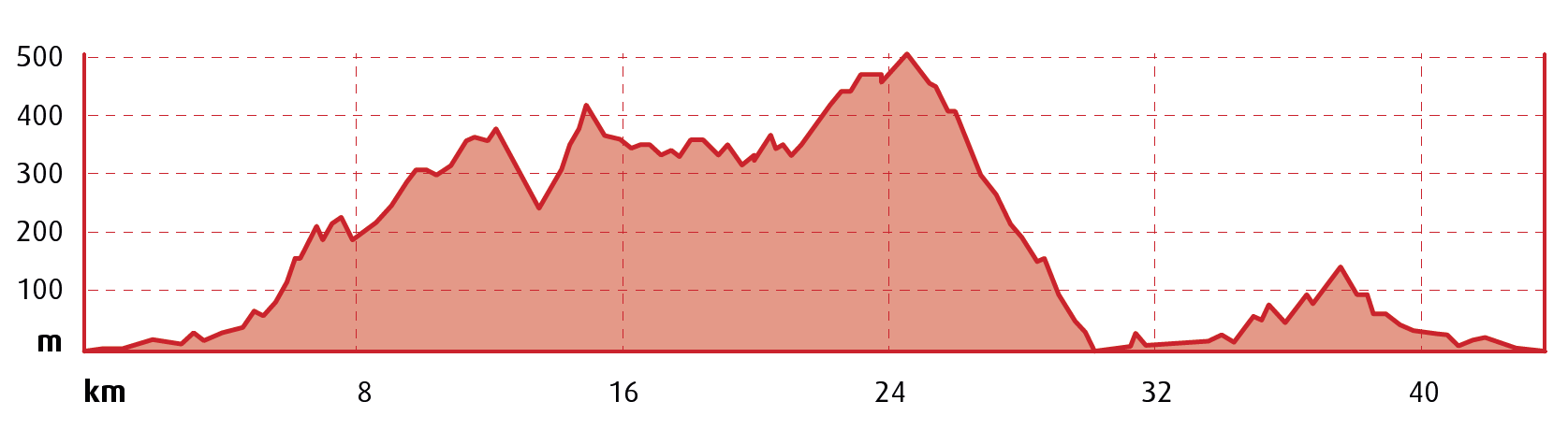
 Distance:
42,5 km
Distance:
42,5 km
 Elevation gain:
987 m
Elevation gain:
987 m
 Max. Elevation:
518 m
Max. Elevation:
518 m
Water points
- Tossa de Mar
We depart from the Central Tourist Office in Lloret de Mar, located in Carrer de les Alegries, and join the C-63 road, which we follow until we reach a filling station. At this point, just below the Chapel of Les Alegries, we take the track on the right, which starts as an asphalt track and later becomes a dirt track with a very good surface. We ride along the flat until we reach the Can Sota farmhouse, where a short but intense climb begins.
After a short flat section, we continue to climb until we skirt around Turó de les Baladres, at an elevation of 230 metres. After another brief flat section we continue to climb up to Turó de Sant Joan, at an elevation of 392 metres.
From here we have a rapid descent down to the GI-681 road, which then climbs to Tossa. This type of track is ideal for building up high speeds. Take care and be ready in advance for braking since the terrain is very sandy with poor grip. Once we’ve crossed the road, we climb again up to the Mallorca Pass, at an elevation of 433 metres.
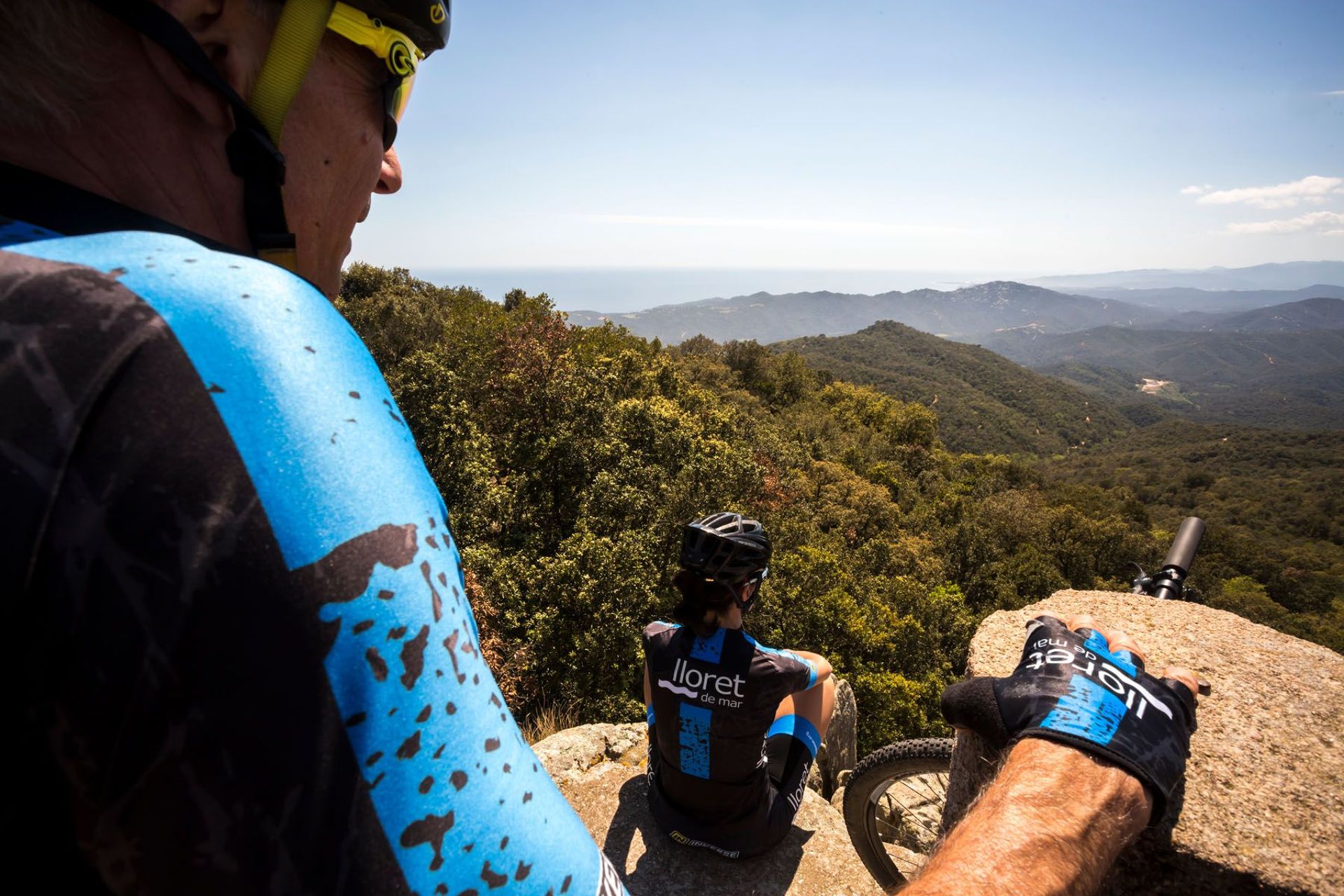
Once we’ve completed the pass, we come to the most straightforward part of the route, along the flat all the way to the Fontbona housing estate. We make our way through the streets of the housing development and continue a fairly undemanding climb, pedalling parallel to the GIP-6821 road, which we soon leave to begin our climb to the summit of Puig de les Cadiretes, at an elevation of 518 metres, the highest point of the route with a fantastic vantage point on top of some rocks that formed part of a mediaeval settlement.
Our descent begins along tracks with a very good surface, leading down to the Tossa Stream, very close to the town of Tossa de Mar. At this point we can stop for refreshments.
We take the GI-681 road for a short stretch, soon exiting it in order to climb alongside the Tossa Stream up to where a campsite is located. A final challenge awaits us: the climb up to the Palomera Pass, at an elevation of just 135 metres, before changing sides and riding down to Lloret, linking up with the track that we took in the opposite direction.
The start and end of this route is in a built-up area shared with motor vehicle traffic; please observe traffic signals and use the cycle lanes to minimise the risk of incidents.
Points of interest
Chapel of Les Alegries: this was the first parish church of the town of Lloret. It’s located 2.5 km from the centre and was the parish church from its consecration in 1079 until 1522. It has a Romanesque bell tower and frescoes by Calàndria. In Lloret, the sea used to cover the entire plain as far as the place known as Les Alegries.
Puig de les Cadiretes: the summit, above some granite blocks, offers amazing views of the Costa Brava and the surrounding area, covered by dense oak and pine forests, along with abundant bushland. Between the summit and the forest watchtower, you can find the remains of a mediaeval settlement, with drystone walls delimiting the quadrangular layout of its structures, supported directly on the granite blocks.