Montbarbat
Montbarbat
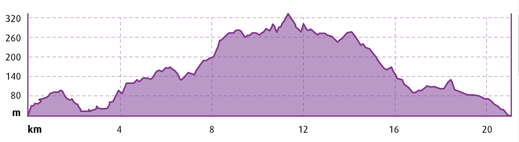
 Distance:
20 km
Distance:
20 km
 Elevation gain:
504 m
Elevation gain:
504 m
 Max. Elevation:
333 m
Max. Elevation:
333 m
We depart from the Central Tourist Office in Lloret de Mar, located in Carrer de les Alegries, heading in a north-west direction, right next to the cemetery. We continue in the direction of the Water World water park, passing behind it into the Condado de Jaruco housing development, which we leave to our right as we begin to climb, following the Passapera Stream.
We climb as far as Turó d'en Trompa (hill) along tracks with a good surface, and with steep gradients in a few short stretches.
From this point we climb constantly in the direction of another hill, Turó del Pi Gros, skirting around Montbarbat on its north-west side.
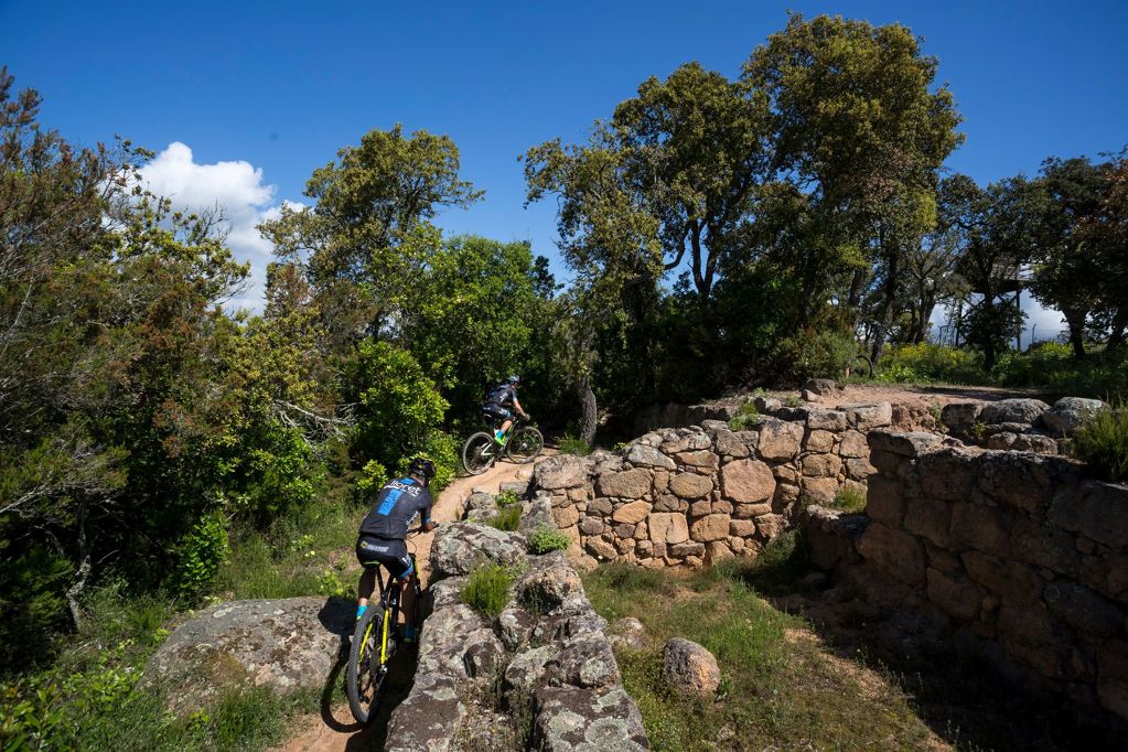
When we reach the highest point of the track we turn right where a water tank is located and, passing next to a chain, we climb up to the summit on a track in good condition. Here we can visit the Iberian Settlement of Montbarbat. This vantage point offers a commanding view of the entire plain of the county of Selva, the sides of the surrounding mountains (Montseny, Guilleries and Cabrerès), the western part of Gavarres Massif and the course of the Tordera River. This is the highest point of the route.
We return along the same path as far as Turó del Pi Gros, where we take a left turn downward along a well signposted track with a good surface and then link up with the GR 92.
Once we’re on the Sant Pere del Bosc road, we can make a brief diversion to visit the Angel Monument before heading back to the track to resume our return journey.
We enter the Condado del Jaruco housing development once again and head back to Lloret de Mar along the same route we used to leave the town, ending up at the Central Tourist Office, the start and end point of the route.
Points of interest
Iberian Settlement of Montbarbat: the Iberian settlement of Montbarbat, dating from between the 3rd and 4th centuries BC, stands at the top of the mountain of the same name, at an elevation of 331 metres. Its location made it a strategic and well-protected site. It’s the largest settlement in Lloret, covering 5,700 m2, and is surrounded by defensive walls and towers.
Some streets have also been uncovered, along with dwellings and other buildings such as food storehouses dating back to the 3rd and 4th centuries BC. Fragments of imported Attic ceramics have been found there, offering a clear indication of Greek presence or influence in the area.
Angel Monument: monument crowned with the statue of an angel with metal wings who points the way to the Chapel of Our Lady of Grace and the path to heaven. A verse by the Catalan poet Jacint Verdaguer is inscribed on the central section of the monument, which reads as follows: "Maria al cel guia per camí de flors anem-hi i correm-hi cantant sos amors" ("Mary in heaven guides us along the flowery path; let us go there, let us run there, singing of her love").